
Most Americans learned the name of the Mississippi River before they could spell it. It showed up in history lessons, geography tests, and classic literature, most famously in Mark Twain’s stories about life on its muddy banks.
But for all its cultural fame, the Mississippi was easy to underestimate. It was not just a long river running through the middle of the country.
It was one of the largest river systems on the planet, a critical source of drinking water and energy, a refuge for a quarter of all North American fish species, and the site of some genuinely strange moments in American history.
Looking closely at what the river had done, and what had happened along it, revealed a body of water far more surprising than its reputation suggested. So, let’s talk more about this amazing river.
Size of a Continent
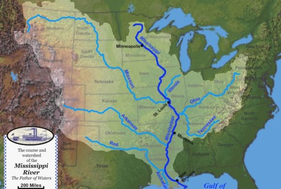
The Mississippi did not travel alone. Its basin, the total area of land that drained into the river and its tributaries, covered more than 1.2 million square miles and collected runoff from 31 U.S. states.
That made it the third-largest river basin in the world, behind only the Amazon and the Congo. In terms of surface area, the Mississippi’s watershed covered more than 40% of the continental United States.
When rain fell anywhere from western Montana to western Pennsylvania, there was a reasonable chance that water eventually found its way into the Mississippi system.
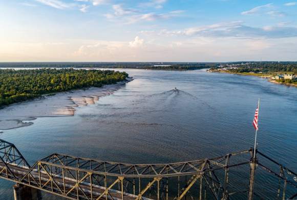
The river itself ran approximately 2,350 miles from its headwaters at Lake Itasca in Minnesota to where it emptied into the Gulf of Mexico in Louisiana. That made it the second-longest river in the United States, about 200 miles shorter than the Missouri River.
It passed through ten states along the way: Minnesota, Wisconsin, Iowa, Illinois, Missouri, Kentucky, Tennessee, Arkansas, Mississippi, and Louisiana. Two state capitals sat directly on its banks, St. Paul in Minnesota and Baton Rouge in Louisiana.
A River of Records
Several of the Mississippi’s physical features had produced records that were difficult to match anywhere else in North America.
At its widest point, where it formed Lake Winnibigoshish near Bena, Minnesota, the river stretched more than 11 miles across. The widest point within the commercial shipping channel was Lake Pepin, which ran about two miles wide. At its narrowest stretch, the same river could barely span the width of a highway.
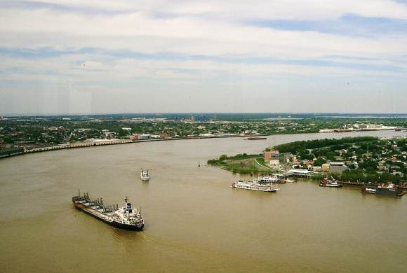
The river’s flow at its mouth was equally staggering. More than 4 million gallons of water poured into the Gulf of Mexico every second. Despite that volume, the water moved slowly enough through the river’s natural bends and man-made modifications that a single drop entering at Lake Itasca took roughly three months to complete the full journey to the Gulf.
Two people had swum the entire length of the river. Slovenian distance swimmer Martin Strel completed it in 68 days in 2002, going on to later swim the Amazon and Yangtze rivers as well. American Navy combat veteran Chris Ring became the second person to finish the swim in 2015, though his journey took 181 days, more than twice as long as Strel’s.
Industry Grew From the Water
St. Anthony Falls, the only major natural waterfall on the Mississippi, played an outsized role in the industrial development of the Upper Midwest. Located near what was now downtown Minneapolis, the falls provided a concentrated source of mechanical power that attracted lumber and flour mills beginning in the 1700s and 1800s.
Sawing timber and grinding grain on the scale that the falls made possible helped transform Minneapolis into a major industrial city.
In 1869, an attempt to extend milling operations above the falls went wrong and caused the falls to partially collapse. Multiple repair attempts failed, and the U.S. Army Corps of Engineers eventually replaced the natural rock face with a concrete wall, completed in 1876.
The wall stabilized the falls well enough to allow flour milling to continue expanding in the area, but the natural waterfall that had originally powered the industry was gone.
The same lake that formed near the river’s widest point, Lake Winnibigoshish, had also contributed one minor but memorable entry to American sporting history.
In 1922, an 18-year-old named Ralph Samuelson became the first person to water ski, testing his idea that the techniques of snow skiing could be translated to a boat and a pair of boards on water.
Samuelson never filed a patent. A New York inventor named Fred Waller obtained the first patent for water skis in 1925 under the product name “Dolphin Akwa-Skees.”
The River Beneath the Surface
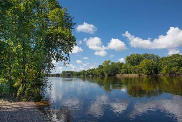
Below St. Anthony Falls, the Mississippi’s character changed. The river widened and slowed, creating a mixture of currents, deep pools, and quiet backwaters that supported one of the most biologically diverse freshwater environments in North America.
At least 260 fish species had been documented in the Mississippi, accounting for roughly 25% of all North American fish species. Carp, catfish, sturgeon, pike, and gar were among the most commonly known, but the river also supported many species that rarely made news and were known mainly to researchers and anglers who spent serious time on the water.
The ecological richness of the river extended well beyond fish. The corridor of forest, wetland, and floodplain along the river’s banks served as a major migration route for birds traveling between North and South America, and the river’s floodplains supported plant communities that had developed over thousands of years of seasonal flooding.
What the River Became
By the 20th century, the Mississippi had been substantially modified by dams, levees, and navigation channels built to support commercial shipping and flood control. The river that travelers could drive alongside today was partly natural and partly engineered.
The Great River Road, a scenic route built in 1938 and running more than 3,000 miles along the river’s course, offered a way to follow the Mississippi from Minnesota to Louisiana without losing sight of it for long. Designated as a National Scenic Byway, the full drive took about 36 hours to complete.
The Mississippi remained one of the country’s most important commercial waterways, carrying agricultural products, industrial goods, and energy resources between the interior of the country and the Gulf Coast.
But it also remained a living river, still supporting an extraordinary range of species, still moving slowly toward the sea, and still surprising the people who looked at it closely enough.
Sources:
Leave a Reply