
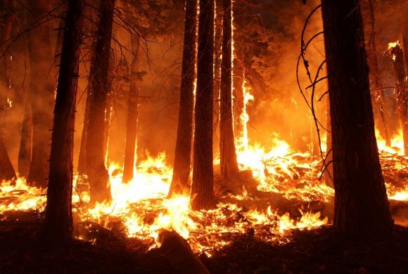
Most people think of fire as something that starts from a spark, a dropped match, a lightning strike, or a campfire left unattended. But before any spark can grow into a wildfire, the weather has to be ready for it.
On certain days, a combination of heat, dry air, low humidity, and strong winds creates conditions so dangerous that weather agencies send out alerts warning the public that fire could ignite and spread with almost nothing to stop it.
This is what meteorologists call fire weather, and it is becoming more common around the world. That’s why, understanding what causes it, and how scientists track it, may lead to something that we never thought of. Thus, we think we need to talk about it in this article.
Not a New Thing

Fire weather is not a new concept, but the formal systems for monitoring and communicating it developed gradually as scientists began to understand exactly which weather conditions made fire most dangerous.
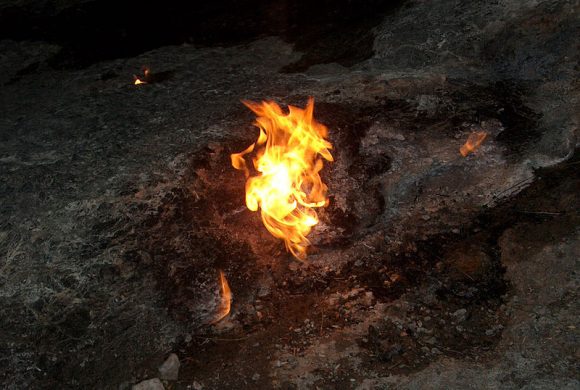
The basic chemistry of fire required three things to come together: heat, oxygen, and dry fuel. Weather affected all three. High temperatures dried out the grasses, leaves, shrubs, and dead wood that fires needed to spread.
When fuels were warm and dry, they reached their ignition point faster and burned more intensely. Low rainfall and drought removed the moisture that normally kept vegetation resistant to burning.
Low relative humidity pulled additional moisture out of fuels and kept them dry. And wind supplied fire with fresh oxygen, carried burning embers ahead of the flames, and pushed the fire faster across the landscape.
Researchers also found that soil moisture played a critical role, sometimes more than temperature or rainfall alone.
A study examining wildfires in the Southern Great Plains found that soil moisture was such a strong predictor of fire activity that it outweighed the contributions of warm temperatures and low precipitation.
When soil was dry, the plants growing in it were water-stressed and far more likely to catch fire.
Advanced Measurement

As scientists mapped out these conditions more carefully, weather agencies developed a system for measuring when multiple fire weather factors appeared at the same time.
In the United States, the National Weather Service worked alongside land management organizations to track dangerous weather patterns. When several fire conditions lined up at once and coincided with dry fuel on the ground, forecasters issued one of two alerts.
A fire weather watch came first, issued when dangerous conditions were expected to develop within the next 24 to 72 hours. It gave fire crews and the public time to prepare. A red flag warning followed when those conditions had already arrived or were expected within 12 to 24 hours.
The specific thresholds that triggered these warnings varied by region. Local ecosystems, plant types, and terrain all affected how fire behaved, so each area set its own criteria.
But at minimum, red flag conditions generally involved wind speeds of 15 miles per hour or more, relative humidity below 25%, and very low fuel moisture in grasses and leaves. When all three occurred together, any fire that started could spread rapidly and become extremely difficult to control.
Fire Weather
Among the weather patterns most closely associated with dangerous fire conditions, two stood out as particularly powerful drivers.
The first was the passage of a dry cold front. After a dry cold front moved through an area, it often brought low humidity and strong, gusty winds behind it. The winds were especially dangerous because they did not just dry out fuels.
They physically pushed flames across the ground, lifted burning embers into the air, and dropped them ahead of the fire’s edge, starting new ignitions before firefighters could respond.
The second was high pressure in the upper atmosphere. When a strong high-pressure system settled over a region, it acted like a lid, trapping heat near the surface, preventing clouds from forming, and pushing dry air downward.
These conditions produced what meteorologists sometimes called heat domes: prolonged periods of very high temperatures, clear skies, and extremely dry air. In fire-prone regions, heat domes were among the most feared weather setups of the year.
Fire weather could occur in any season, but it peaked during late summer and autumn, when fallen leaves and dormant trees provided large amounts of dry fuel. Regions like the western United States, Australia, parts of Africa, and the Amazon faced the highest risk, though fire weather had been recorded on every continent with significant vegetation.
Interesting Pattern
The pattern that concerned scientists most was not any single fire weather event but the long-term trend. A study published in the journal Nature Communications found that between 1979 and 2013, fire weather seasons had grown longer by an average of 19% across one quarter of Earth’s vegetated land.
In the forests of the western United States, fire weather seasons had extended by eight days. Longer-than-normal fire weather seasons also became 53% more frequent globally over the same period.
Research focused on California found that increases in autumn temperatures and decreases in rainfall since the 1980s had already produced a 20% rise in fire weather conditions. If those trends continued, the state could see a 25% increase in dangerous autumn fire weather days by the year 2100.
The connection to climate change was direct. As global temperatures rose, the conditions that made fire weather possible, heat, dry air, and drought, were becoming more common and lasting longer into the year.
Fire weather seasons that once had clear boundaries were stretching into months that had previously been relatively safe.
For fire agencies and the communities they protected, that meant a shrinking window of lower-risk weather between one dangerous season and the next, and a growing need to treat fire readiness not as a seasonal concern but as a year-round one.
Sources:
Leave a Reply